Surveying & Mapping UAV Solution
Product-Level Solution, Rapid Innovation for Diverse Frames.
Multi-Rotor Mapping UAV Product Solution
Based on the the expertise in core components, SIYI offers a high-performance multi-rotor mapping UAV solution,
which can be quickly adapted to a variety of different frames.
Covering link & controllers, gimbal cameras, autopilots, propulsion systems and software, support Ardupilot/PX4.
Ready to use out of the box! Helping you rapidly accelerate your innovation speed!
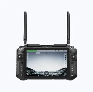
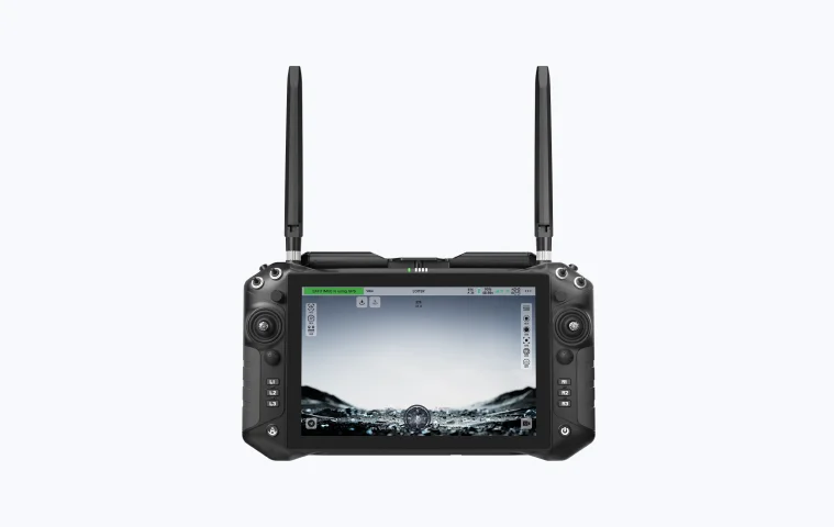
UniRC 10 PRO
Triple-Frequency Professional Ground Station
 Triple Frequency 45KM Transmission (Ground-to-Air)
- 10.1 inch + 2000nit + 27CH
- Dual Control
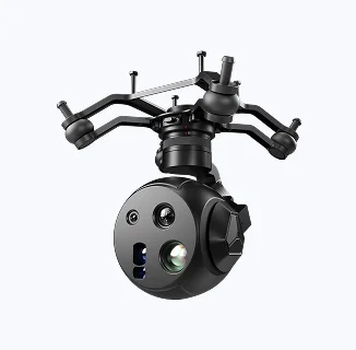
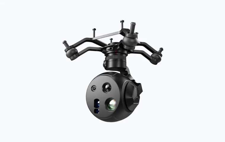
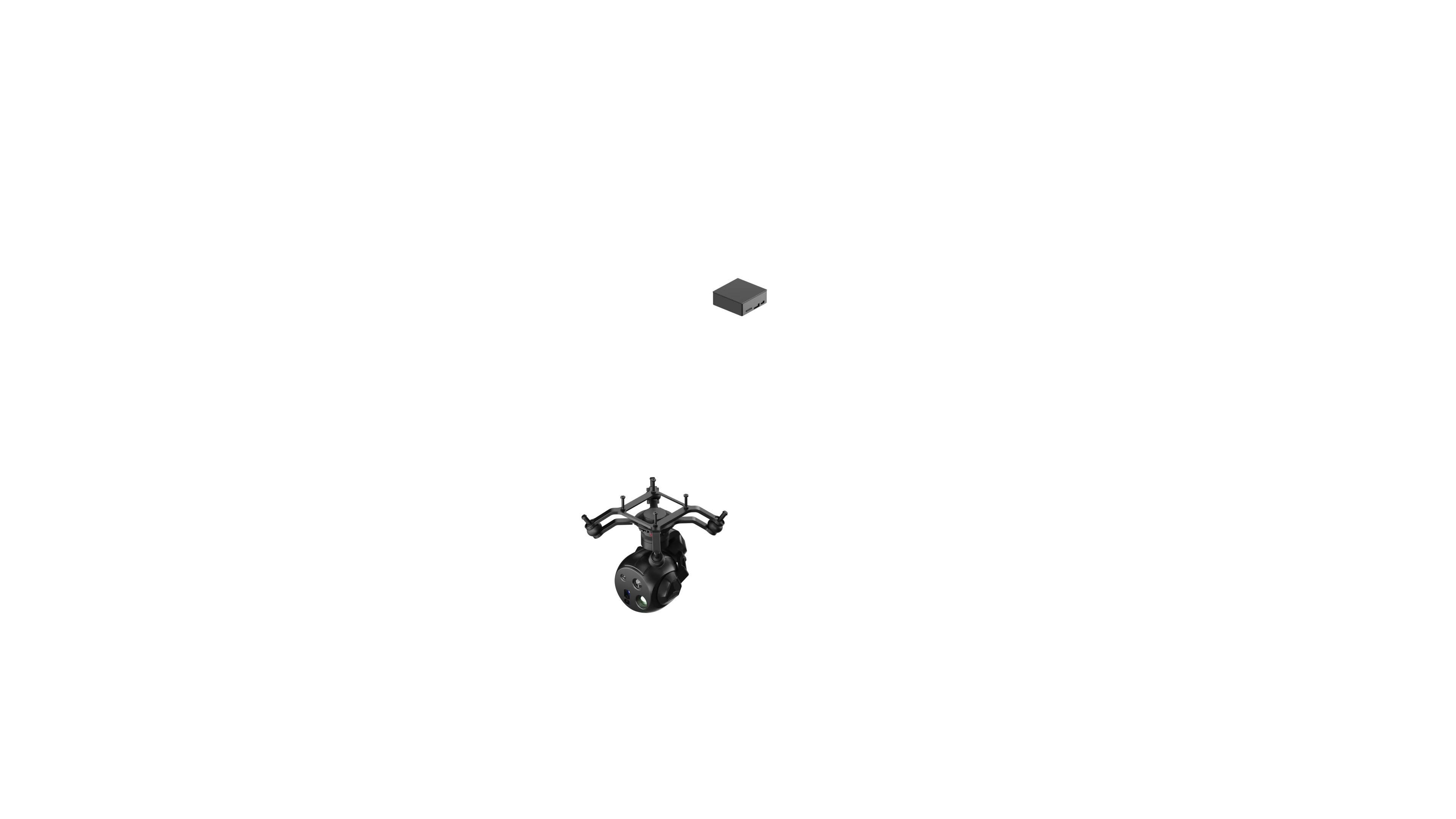
UniPod MT11
New-Era Multi-Sensor Optical AI Pod
- 8K + 48MP + 165x Zoom
- HD IR Vision + LRF function
- Built-in 10T AI, Human/ License/Fire Tracking
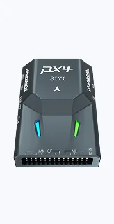
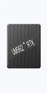
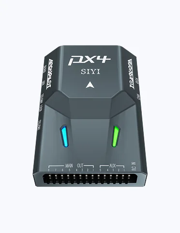
N7 + RTK Positioning & Orientation Module
High-Precision Flight and Operation Control
- 480MHZ High-Efficiency, Dual IMU/Magnetometer Redundancy.
- Centimeter-accurate Operation.
- Support Ardupilot/PX4, etc.
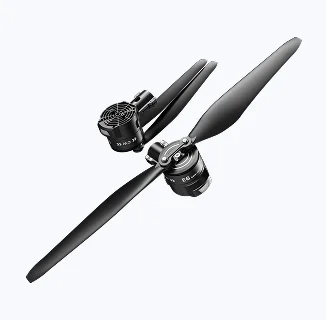
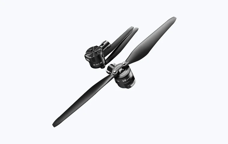
E6 Series
Surging Thrust, Fly with A Bold Heart
- Max Thrust 12.5kg per Axis
- Propeller Diameter*Pitch: 24*9.0 inches
- Suitable for Drones with a Wheelbase of over 900mm

UniGCS
Mixed-Source Ground Station Software
- Intelligent Route Planning
- Customizable Payload Control
- One-Stop Parameter Tuning & Operation
Empowering Intelligent Surveying Operation
Provide highly integrated product-level solutions, allowing selection of appropriate product components basedon actual project requirements. Equipped with the UniGCS software, supporting various intelligent routes planning. Empower intelligent surveying operation.
Benfits
Link & Controller, Gimbal Cameras, Autopilots, Propulsion Systems, Software. All core components, fast integration!Empower global industriesk quickly integration & innovation, tailored to meet project requirements.
System-Level Deep Integration
Compared to traditional piecemeal assembly, SIYI provides a unified architecture with underlying protocols fully bridged. Power, flight control, link, and payload coordinate seamlessly, significantlyenhancing system stability, simplifying wiring, and enabling rapid installation.
Ultra-Low Total Cost of Ownership (TCO)
Through in-house R&D across the entire industrial chain and large-scale production, hardware procurement costs are significantly reduced. The modular maintenance design drastically lowers the total lifecycle operational cost.
Precise and Efficient
Using RTK dual-antenna heading determination technology, it completely eliminates reliance on a magnetic compass. Even when operating right next to a 500KV power line, it maintains centimeter-level stable hovering, enabling fine-detailed inspection of insulators.
Applications
4-Axis Surveying & Mapping UAV
SIYI x REEBOT | UniRC 7 Pro + UniPod MT11 + D6 Series + UniGCS
4-Axis Surveying & Mapping UAV
SIYI x QIYU | UniRC 7 Pro + UniPod MT11 +
N7 + UniGCS
Mini 4-Axis Surveying & Mapping UAV
SIYI x CAVOK | UniRC 7 Pro + N7 + UniGCS
Contact Us
Surveying Drone Solutions