Forests shelter 80% of Earth's terrestrial species. Globally, forestry departments now deploy drones to monitor wildlife distributions, population dynamics, and habitat changes with minimal disturbance - slashing field risks while boosting efficiency. Across China's Qinling Mountains, Greater Khingan Range, and Xishuangbanna rainforests, thermal-equipped drones have become critical anti-poaching tools, enabling rangers to detect hidden threats through infrared vision.
Wildlife protection patrols in forest areas are an extremely complex process. Due to dense vegetation, extensive tree canopies restrict the observation capabilities of visible-light cameras. Turbulent airflows in mountainous regions affect flight stability, while trees in forested areas strongly absorb radio signals, making image transmission and control signals prone to interruption. Coupled with potential magnetic field interference from mineral deposits, these factors pose a significant challenge to the stability of the entire system.
1. Canopy Interference: Dense foliage blocks visible-light observation.
2. Signal Degradation: Trees absorb radio waves, causing transmission failures.
3. Turbulent Terrain: Mountain winds and magnetic interference challenge flight stability.
4. Professional Operation Threshold: Open-source systems overwhelm frontline rangers.
To solve these obstacles, SIYI provides you an integrated solution with "UniRC 7Pro Handheld Ground Station" + "ZT30 EO/IR/LRF Camera" + "N7 Autopilot" + "UniGCS Software".

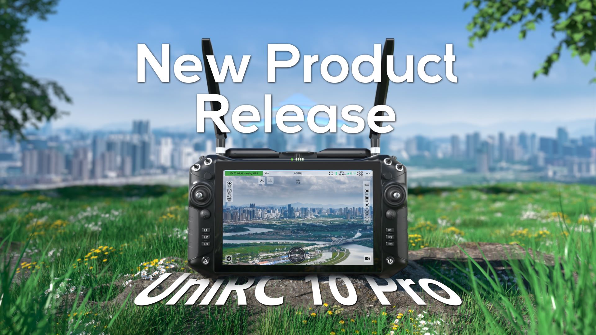
UniRC 7Pro: 40km Dual-Frequency Transmission
In October 2024, SIYI Technology launched the new UniRC 7 series high-performance handheld ground stations. Over the following year, thanks to its stable long-distance image transmission and 2.4G & 5G automatic frequency hopping function, it has shown excellent performance in forest patrol and wildlife protection scenarios.
✅ 40km Stable Transmission: Maintains clear feeds despite signal attenuation (12.5km@200m altitude, 20km@500m in validation tests).
✅ Auto-Switching Dual Band: Seamlessly shifts between 2.4GHz/5GHz to bypass interference.
✅ Precision Control: Dedicated gimbal joystick enables target locking mid-flight.
✅ Dual-Operator Mode: Pilot + payload specialist collaboration reduces skill thresholds.

Affected by complex forest stand interference, even if rapid patrol flights can be conducted above the tree canopy, dense vegetation still limits visible-light observation. SIYI Technology's ZT30 four-sensor optical pod integrates a 4K ultra-wide camera, a 30x optical zoom & 180x hybrid zoom camera, a 640×512 infrared camera, and a laser rangefinder camera, providing high-definition vision for forest patrol drones.
Multi-spectral observation capabilities:
1. 30x Optical Zoom: Identifies targets through dense canopy.
2. Dual-Screen IR/Visible Light: Detects hidden animals/poachers in all conditions.
3. Laser Rangefinder: Pinpoints GPS coordinates of wildlife sightings.
4. AI Fire Detection: Integrated smoke recognition for forest protection.

N7 Autopilot: Stability Redefined
Wildlife habitats are often deep in mountainous forests with complex terrain. Affected by turbulent mountain airflows, the flight stability of drones is severely tested. SIYI Technology's N7 industrial-grade autopilot, while boasting the advantages of strong universality and easy integration from open-source ecosystems, is also equipped with rich interfaces to support diversified application expansion.
Engineered for harsh environments:
✅ Dual IMU Redundancy: Prevents crash scenarios.
✅ Dual Magnetometers: Counters magnetic interference from mineral deposits.
✅ Heated IMU: Ensures -20°C operation.
✅ cm-Accuracy RTK: Maintains position hold in turbulent valleys.

UniGCS Software: Simpler and More Compatible Drone Control
To help complete machine manufacturers quickly respond to demands and achieve rapid integration and innovation, SIYI Technology has launched the UniGCS ground station software that combines the advantages of both open-source and closed-source ecosystems. Developed based on Ardupilot and PX4 open-source protocols, it is compatible with all MAVLink open-source ecosystem products. The ground station's control interface is simpler, with more clearly integrated functions, which better conforms to the control logic of frontline pilots, allowing them to operate the drone as easily as using an iPad.
Transforming complex operations:
1. Intuitive Interface: Smartphone-simple workflow.
2. Auto-Patrol Routes: One-touch takeoff/landing frees focus for observation.
3. Smart Fail-Safes: Automatic return-home on critical alerts.
4. Centralized Dashboard: Airspeed, altitude, and wind data at a glance.

Impact:
This integrated solution already empowers dozens of projects, replacing high-risk manual patrols with remote-controlled precision. Rangers now conduct surveys from station bases, slashing exposure to hazardous terrain while accelerating response times.
As low-altitude economies expand globally, SIYI TECH continues to drive innovation from the component level - delivering robust, accessible technology that makes conservation smarter, safer, and more effective.

Scan to follow the official account